Yosemite is a 4 hour drive from San Francisco. Along I-580 at Altamont Pass, we saw the large windmill farm. This is one of the most consistently windy areas in the world and has thousands of windmills generating electricity.
Outside the park, US-140 has a one-lane temporary bridge detour around a huge landslide. Looks impossible to clean-up. Map software says US-120 is the best route; I took US-140 because it was the route I have taken before.
Several of the roads in the valley were closed for repairs. We could still get around with some difficulty, they changed some of the one-way roads to two-way to compensate. They will probably have the roads fixed before the busy season.
The road to Glacier Point was scheduled to open on our last day, but the rain delayed opening. The Tioga Pass road does not open until later in May or sometimes as late as June.
If the weather turns bad, don’t put away your camera, some of the best shots are with dramatic clouds and fog.
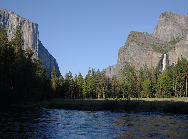
Standard shot from the turn-out. Best shot in afternoon to sunset with clear skies. The 1997 flood washed away some of the interesting river features. For morning shots with thick stormy clouds, I think Tunnel View is better.
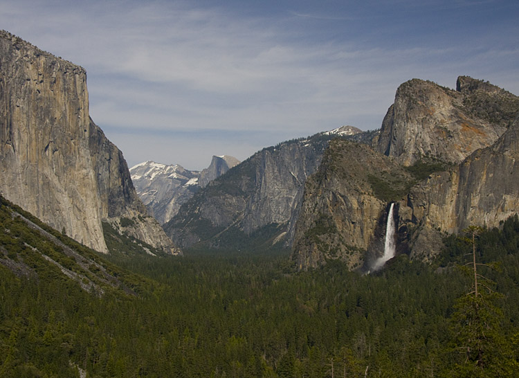
Anytime with thick stormy clouds or afternoon to sunset shot with clear skies.
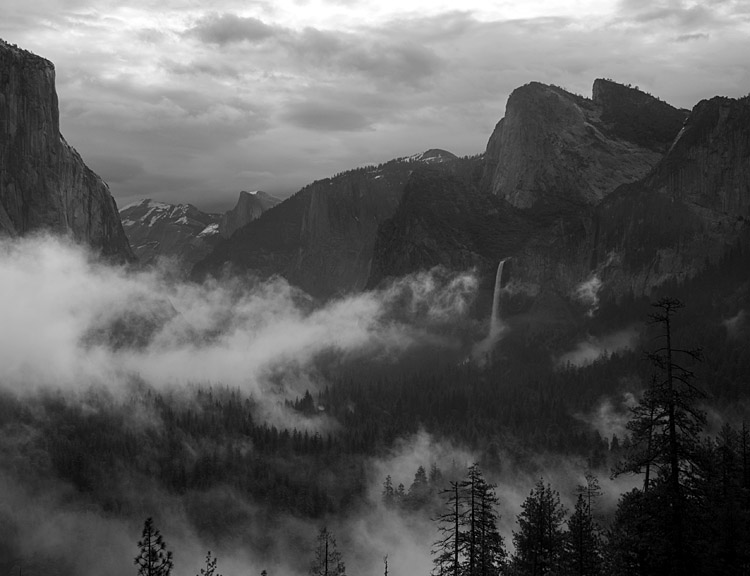
Morning shot in stormy weather. I have about 50 variations of this spread out over one hour. Fog is constantly changing, sun brightness varies. I am not happy with the post processing on this one yet.
On US120, there is a large turnout after the 3 tunnels. This is many miles from the valley, need a telephoto. Not sure if this is the official name, some guys who seemed to know what they were doing told me about it.
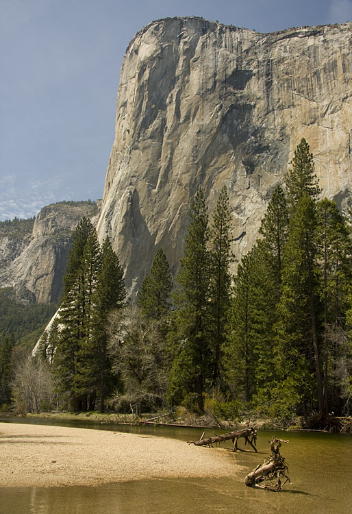
Taken early afternoon from Cathedral Beach.
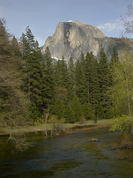
Stoneman Bridge & Half Dome Reflection: I don’t think you can get this shot anymore; the 1997 flood changed the shoreline of the river.
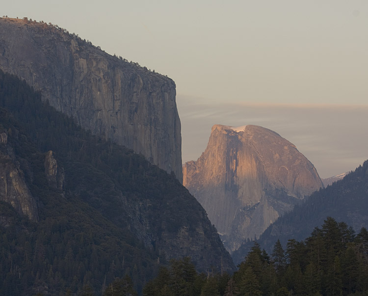
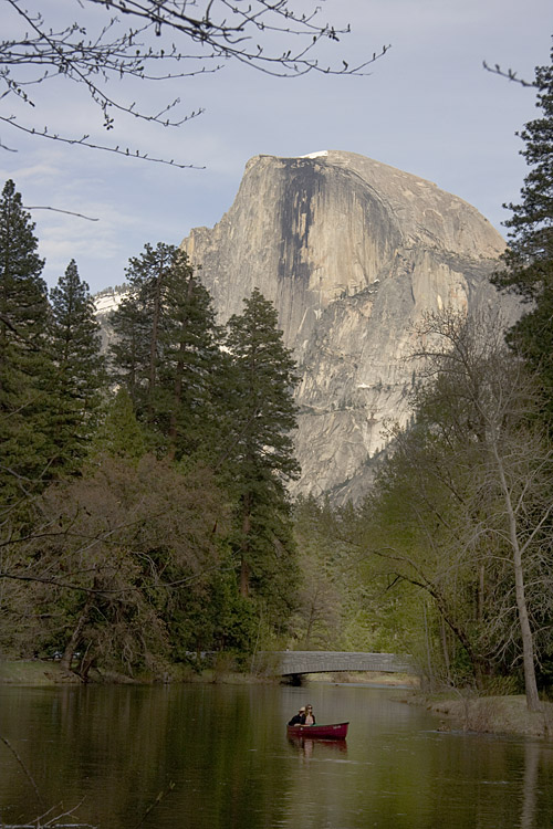
Half Dome from Sentinel Bridge, late afternoon. Need a still river for a good reflection. The trees have grown since Ansel Adams' famous shots and the view is not as good now.
I found a small area in the meadow near the pedestrian bridge where I could get the river and the Sentinel Bridge in the foreground. Only room for one person however. The red canoe was an unexpected bonus. Too bad they don't know the rule of thirds.
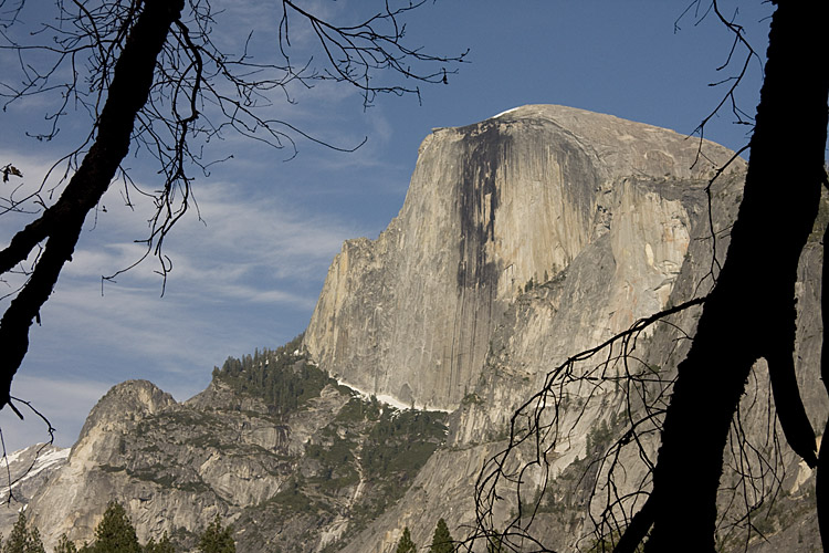
Looking for a different view, found a dying tree to frame it.
Best from meadow on a clear day. Get shot before late afternoon when the shadow of nearby mountain starts shading a portion of the falls. I couldn’t find a reflection in the river. The meadow had some standing water that was useable for reflections.
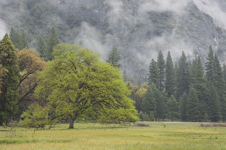
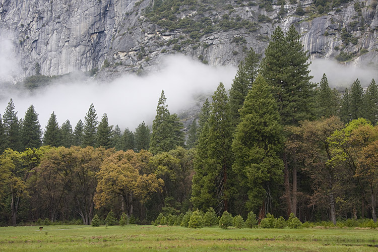
Other Shots from the Meadow:
Shades of green. Fog highlights the trees nicely.
Very heavy mist from the falls can make this difficult in the springtime. Bring plastic bags to cover your camera. The mist dispersed the light making the focus look soft.
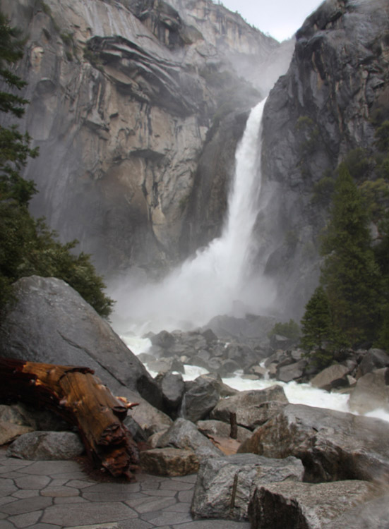
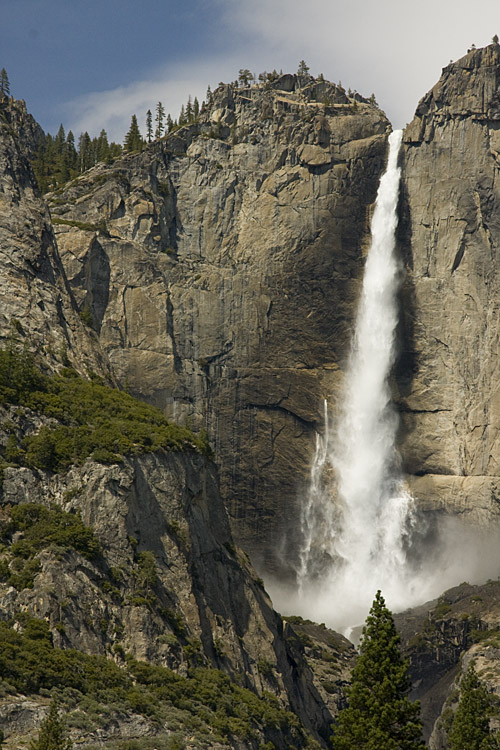
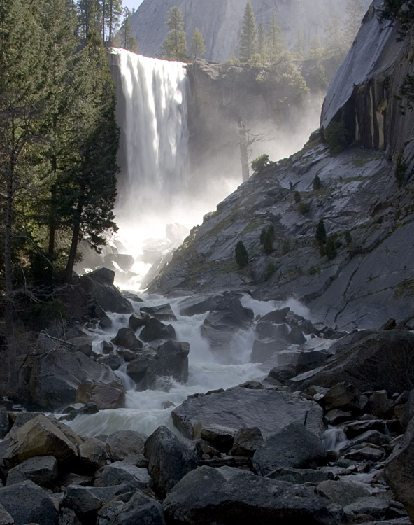
A 0.8 mile moderate to strenuous hike to the bridge. Views are only fair from the bridge. A better spot is about 0.3 miles past the bridge; carefully walk out to the large flat rock. If the sun is out, the dynamic range between the sunlit falls and the deep shade of the river is nearly impossible to deal with. Bring a poncho if you continue to the mist trail (we didn’t continue).
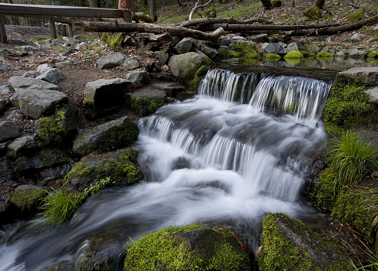
On an overcast day when the light was terrible for everything else, I tried these small falls. Get down as low as possible.
Yes, I felt a little stupid shooting a 2 foot waterfall with all the other huge waterfalls nearby.
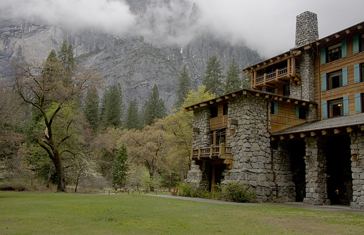
Beautiful historic hotel. Nice views from the back. Be sure to check out the public areas inside also.
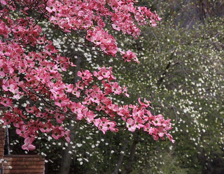
There are several Dogwood trees near the open field where the road to the hotel begins.
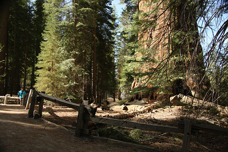
Near Wawona, about a 1 hour drive from the valley.
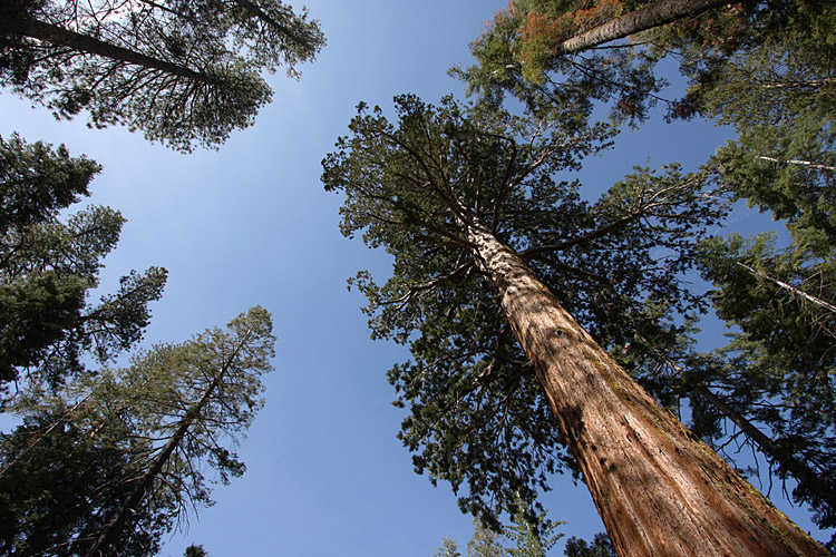
Grizzly Giant Tree, one of the biggest.
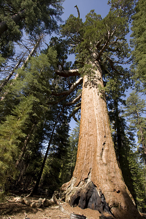
Grizzly Giant trunk, For a size comparison I had Zorrie stand the same distance from the camera as the tree.
All images copyright 2009 by Matt Muskovac.